

Accra, Ghana — A climate researcher and PhD student, Nana Esi Badu-Ansah, has highlighted the importance of Geographic Information Systems (GIS) training in strengthening the capacity of researchers to undertake climate modelling, mapping and other forms of spatial analysis.
Badu-Ansah, who participated in the GIS specialisation under the Africa Climate Collaborative (ACC) at the University of Ghana, said the training had come at a critical point in her professional development and would have direct applications in her research.
The Africa Climate Collaborative at the University of Ghana has been implementing professional short courses designed to equip young people with practical skills in climate resilience and sustainability. The programme includes GIS and other geospatial training pathways, in partnership with the Department of Geography and Resource Development.
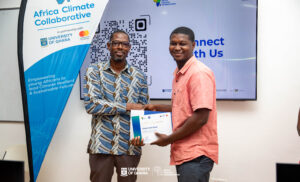
Speaking about her experience, Badu-Ansah said the skills acquired through the GIS specialisation would enable her to apply spatial tools more effectively in her work as a researcher.
“Beyond academics, it will help me with my professional life because I’m a researcher, and then again, I’m even into climate research. With the use of GIS, I’ll be able to do climate modelling. I’ll be able to do the mapping.”
She described the opportunity as particularly significant because it was her first experience working with GIS.
“To be frank, this is my first time using GIS, so this has really come in handy at the right time. It is a very timely opportunity for me in my professional area,” she said.
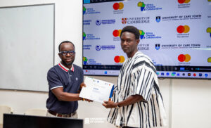
Badu-Ansah is pursuing a PhD in Climate Finance and is also involved in hydrology research at the UK Centre for Ecology and Hydrology. She said the practical GIS skills would therefore complement both her academic studies and professional research.
From training to practical application
Rather than viewing the training as an academic qualification alone, Badu-Ansah said she intended to integrate the skills into her ongoing research and professional activities.
She said the knowledge gained would be particularly useful when assessing climate-related trends, analysing spatial data and producing maps that can support evidence-based research and decision-making.
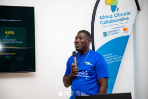
“I know that there will be evaluations, midterm evaluation and then the subsequent years, and I would really highlight the fact that it is needed in my work, in my professional work, every time,” she said.
According to the Africa Climate Collaborative, its broader objective is to empower young people to undertake cutting-edge research, lead climate-resilient development and contribute to sustainable and inclusive green economic growth.
The initiative also supports postgraduate researchers through Master’s, PhD and postdoctoral fellowships, with a focus on climate resilience and sustainability-related research.
Badu-Ansah said her experience demonstrated the importance of practical skills development alongside academic training, particularly for researchers working on complex climate and environmental challenges.
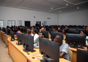
“This is not something that I will just put a certificate under my drawer or something. I’m taking this skill and using it as a researcher in climate research,” she said.
She expressed gratitude to the Africa Climate Collaborative for providing the opportunity and said she expected the GIS skills to remain relevant throughout her professional career.
The GIS training forms part of the Collaborative’s wider effort to build a generation of climate-ready professionals and researchers equipped with practical tools for addressing Africa’s climate and sustainability challenges.
Source: www.climatewatchonline.com